Research Spotlight: Grizzly Bear
Using data from the fRI Grizzly Bear Research Program, decision support tools have been developed to better understand and manage the effects of forestry and other development activities on grizzly bears in Norbord’s Southern Operating Area and surrounding landbase.
This section was prepared by Gordon Stenhouse, Project Lead, fRI Research Grizzly Bear Program. For more information on this program, please visit: https://friresearch.ca/program/grizzly-bear-program.
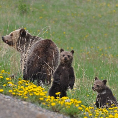 Photo: Ashley Hillman
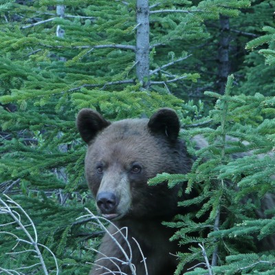 Photo: FRi Grizzly Bear Program
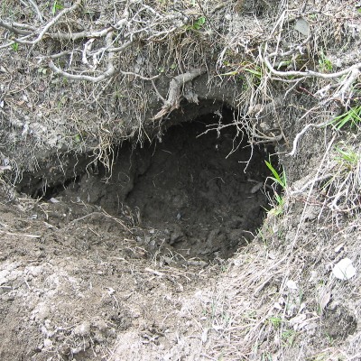 Photo: FRi Grizzly Bear Program
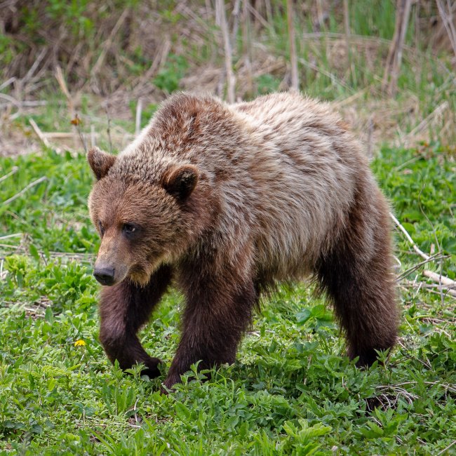 Photo: Arthur T. LaBar
Introduction
The fRI Grizzly Bear Program (1998-2021) is a long-term research program started with the goal of providing knowledge and tools to ensure the conservation of Grizzly Bear in Alberta. A primary focus has been to determine how Grizzly Bears respond to forest management activities in Alberta. Norbord has been an ongoing sponsor and supporter of this applied research effort for many years.
This research program has provided valuable and important insights on how Grizzly Bears interact with and respond to active forest management and forest regeneration in Alberta, along with other development activities in multi-use landscapes. This section provides an overview of Grizzly Bear planning tools that can be used to support forest management and land use planning, including:
- Identifying important Grizzly Bear habitat
- Identifying and managing human-caused mortality risk
- Identifying denning habitat
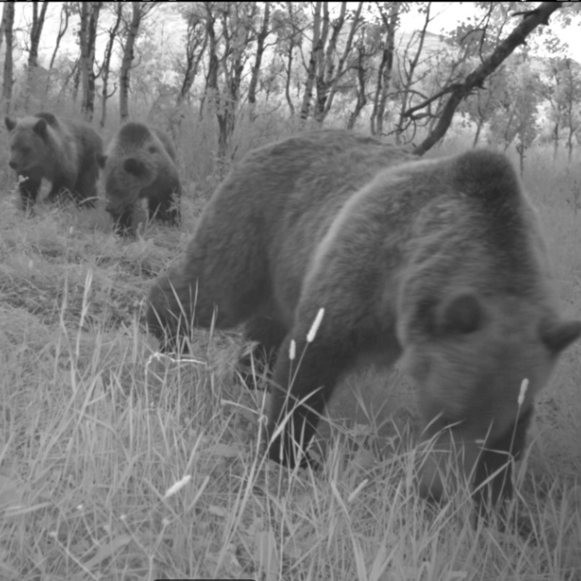
Camera trap photo of a bear and her cubs
About Grizzly Bears
In Alberta, the Grizzly Bear was listed as “Threatened” under Alberta’s Wildlife Act in 2010 due to high levels of human-caused mortality, and concerns about habitat degradation and loss.
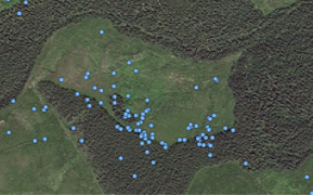
- Grizzly Bears occupy very large home ranges—males' can exceed 1000 km2 while the home range for females can be greater than 500 km2. To view the movements of two Grizzly Bears in the Rocky Mountain foothills over July and August of 2019 click the button below.
- Grizzly Bears are considered to be slow reproducing animals as they reach sexual maturity at approximately age 5. Cubs (usually twins) stay with their mother until they are in their second year of life.
- This species is long lived with bears known to live up to 31 years of age in the wild in Alberta.
- Grizzly Bears are omnivores relying on a variety of foods depending on the time of year. Their diet is primarily vegetation but they also prey on ungulates (moose, deer, sheep, and elk) as well as smaller mammals such as squirrels, beavers, and marmots. Food is often seasonally dependent—ungulate calves are an important food source in the spring (primarily moose and deer in Alberta), while berry patches are a major food source in the fall prior to denning.
- Denning generally takes place between November and April but the duration of time in the den is affected by environmental factors and the sex, age, and reproductive status of the bear.
Grizzly Bears and Forestry
Grizzly Bears use of a variety of habitats to meet their needs, including young regenerating forests. Research indicates:
- Forest harvesting can increase food resource availability for Grizzly Bears. Areas with more bear foods have a higher density of bears.
- Fruit production can be enhanced at forestry-created cutblock edges, which can attract bears.
- Grizzly Bears that use forestry cutblocks are bigger in size. Bigger female bears produce more cubs, which are larger and have a higher rate of survival.
However, access roads created by forestry and other development activities can negatively impact bear populations because of the mortality risk associated with human-bear interactions. Areas around roads can act as habitat sinks.
Bear activity in harvest area
Grizzly Bears in Norbord's Operating Areas
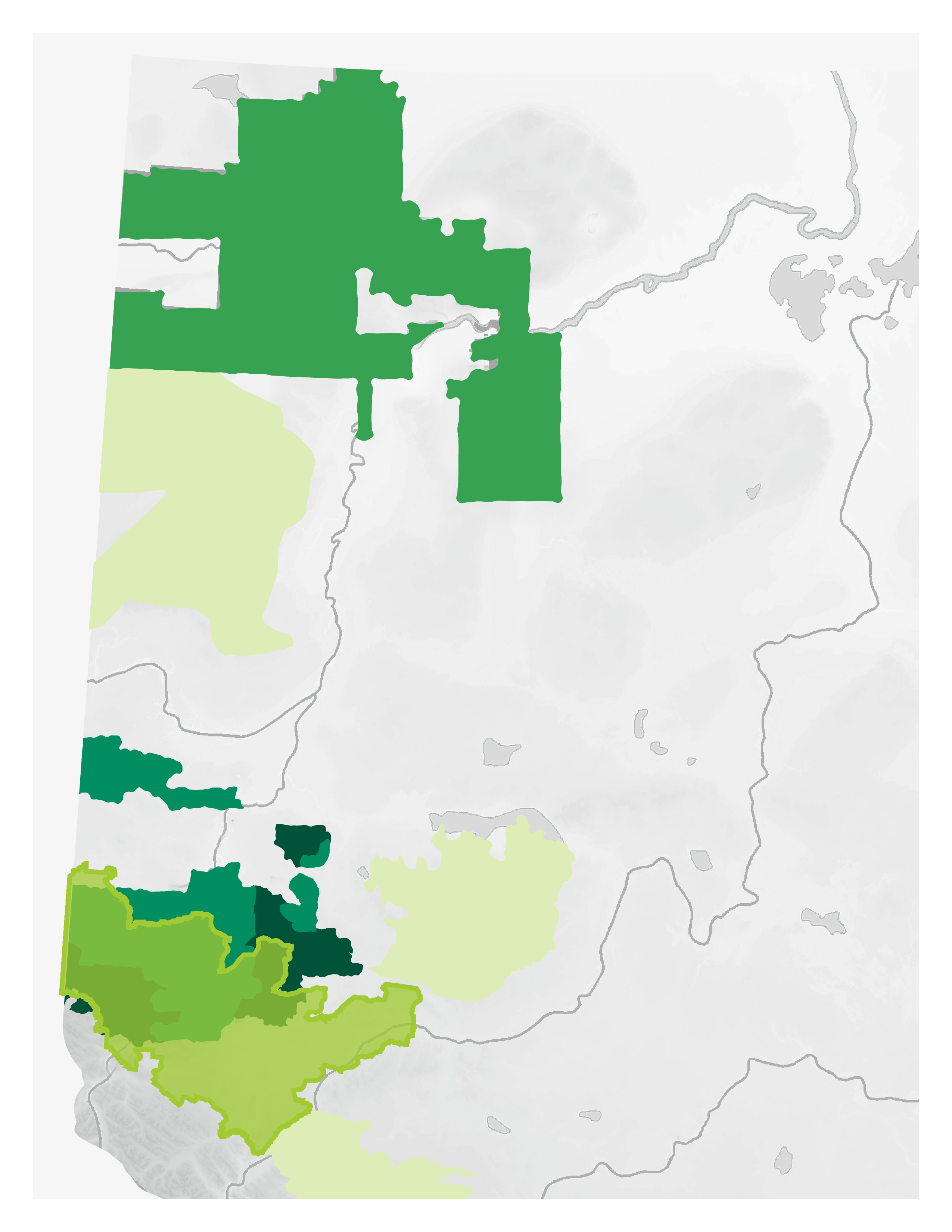
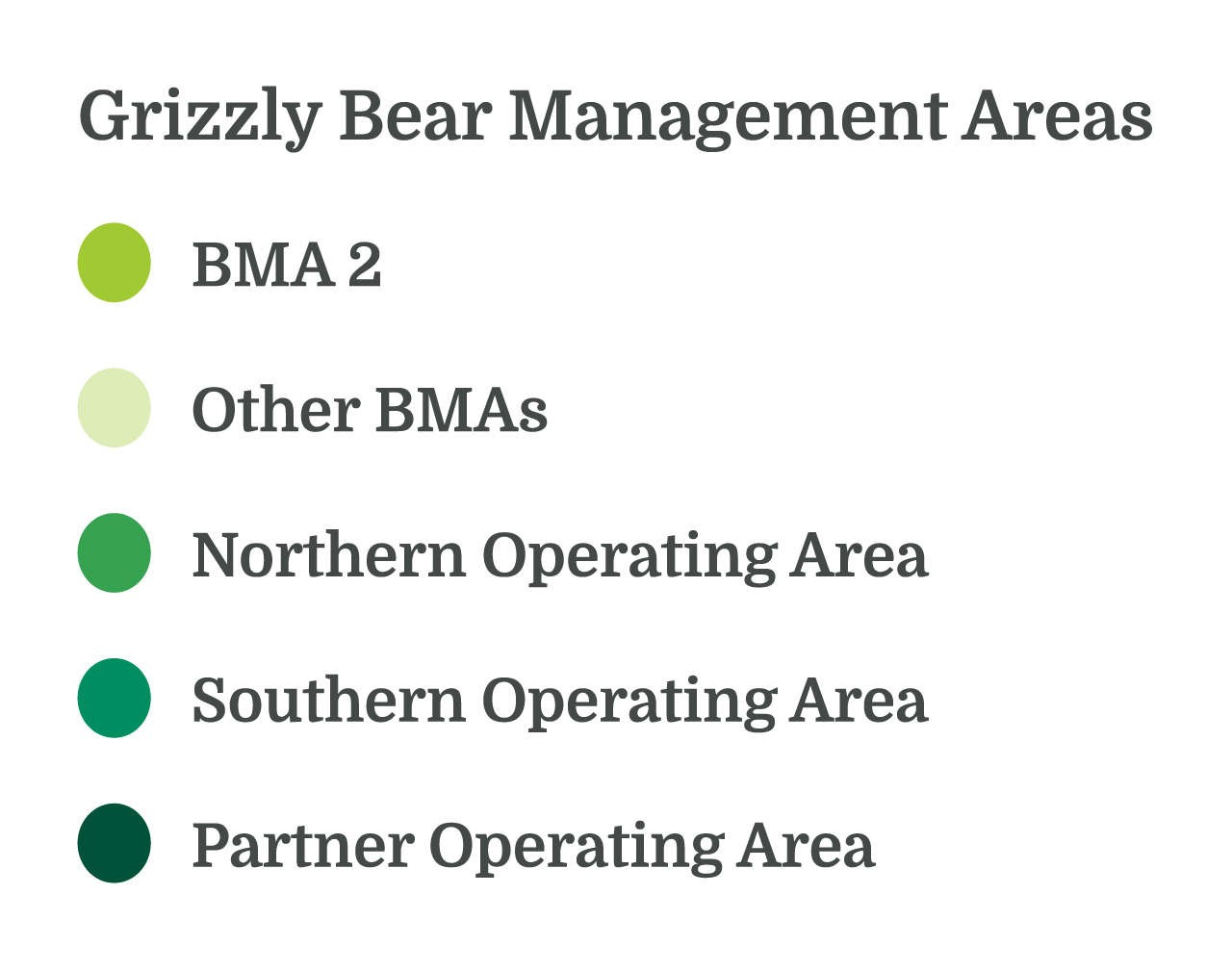
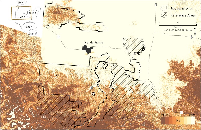
- Alberta Environment and Parks recognizes seven genetically distinct Grizzly Bear population units referred to as Bear Management Areas (BMAs). Norbord’s Southern Operating Area overlaps with BMA 2 (Grande Cache); results from the grizzly bear decision support tool—GBtools Package—are demonstrated for this area.
- The population estimate of BMA 2 was 271 grizzly bears (circa 2008) with a density of 18 bears/1000 km2—this is the highest number and density of Grizzly Bears in the province.
Grizzly Bear Decision Support Tool
The GBTools package was developed to support landscape management planning for Grizzly Bears. This suite of tools allows the user to forecast the future landscape conditions for Grizzly Bears based on the input of new land use activities (e.g., roads, well sites, and cutblocks). The intent is that various planning options can be explored to evaluate the impacts of new development activities on:
- Grizzly Bear habitat supply;
- mortality risk;
- access management, and;
- understanding sightability on the landscape to reduce the likelihood of Grizzly Bear poaching events.
By comparing the output of various planning options, the best landscape option(s) to promote Grizzly Bear conservation and recovery can be identified.
Two key inputs of this tool—important Grizzly Bear habitat and mortality risk—are presented for Norbord’s Southern Operating Area. Den sites are also discussed.
Important Grizzly Bear Habitat
Foraging requirements primarily drive habitat selection by Grizzly Bears. The distribution and abundance of preferred Grizzly Bear food varies greatly both spatially and temporally, with Grizzly Bears typically concentrating their activity seasonally in the most productive foraging habitats. Young forested stands regenerating following forest harvesting can provide abundant food sources.
- In the Southern Operating Area, high value Grizzly Bear habitat is predicted to occur in the area north of Grande Prairie as well as in the southern part of the landbase.
- Change in habitat quality can be updated with new information on the distribution of human footprint, such as new roads and harvest areas.
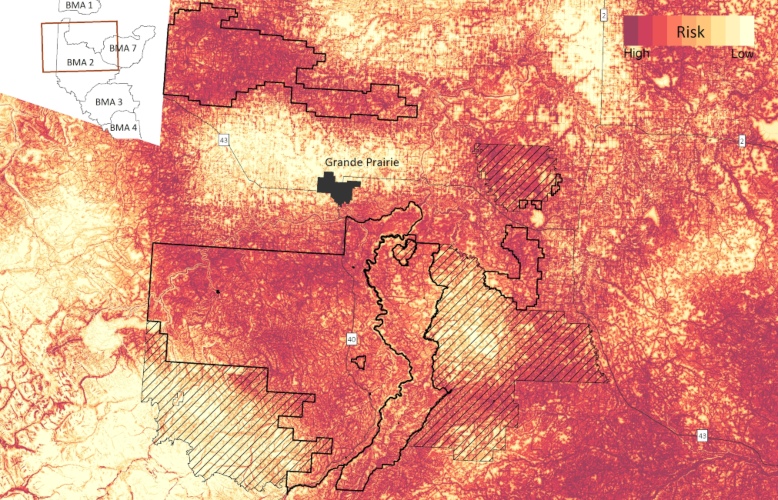
Mortality Risk
The creation of access roads as a result of forest harvesting and other development activities increases the mortality risk for Grizzly Bears.
- Roads provide access to Grizzly Bear habitat, increasing the potential for human-bear interactions. Grizzly Bear survival rates decline primarily due to poaching events that result from this access.
- Further, the creation of roads also creates habitats adjacent to roadways that are attractive to bears. These areas are referred to as population sink habitats because the mortality risk associated with roads can outweigh the benefits of increased food availability.
Therefore, understanding where human-caused mortality risk is high is critical to managing for Grizzly Bears.
Den Sites
Grizzly Bear denning habitat maps spatially identify where Grizzly Bears are most likely to den on the landscape (map not shown because this is sensitive information).
- These maps show the probability of Grizzly Bears denning within each BMA and are a valuable tool to aid in pre-construction activities and for wildlife surveys that occur before winter harvesting operations.
- Denning maps can be updated with landscape change information with new cutblocks, roads, wellsites, etc.
Grizzly Bears often excavate their own winter dens.
Conclusion
Grizzly bears are a threatened species in Alberta and as such a species of management concern in the landscape where Norbord operates. Given that Norbord's Southern Operating Area is an active landscape with multiple agents of change, including forestry and other development activities, the decision-support tool—GBTools package—can improve understanding about the cumulative effects of disturbances on grizzly bears as well as support forest management planning.
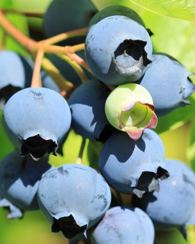
Berries are an important food source for grizzly bears.
Further Reading
- Boulanger, John. and Gordon B. Stenhouse. 2014. The Impact of Roads on the Demography of Grizzly Bears in Alberta. PLoS ONE 9(12).
- Coogan, Sean C. P., Nicholas C. Coops, David M. Janz, Marc R. L. Cattet, Sean P. Kearney, Gordon B. Stenhouse, and Scott E. Nielsen. 2018. Towards Grizzly Bear Population Recovery in a Modern Landscape. Journal of Applied Ecology (July):1–7.
- Nielsen, Scott E., J. Cranston, and Gordon B. Stenhouse. 2009. Identification of Priority Areas for Grizzly Bear Conservation and Recovery in Alberta, Canada. Journal of Conservation Planning 5:38–60.
- Nielsen, Scott E., M. S. Boyce, and G. B. Stenhouse. 2004. Grizzly Bears and Forestry I: Selection of Clearcuts by Grizzly Bears in West-Central Alberta, Canada. Forest Ecology and Management 199(1):51–65.
- Nielsen, Scott E., Robin H. M. Munro, E. L. Bainbridge, Gordon B. Stenhouse, and Mark S. Boyce. 2004. Grizzly Bears and Forestry II. Distribution of Grizzly Bear Foods in Clearcuts of West-Central Alberta, Canada. Forest Ecology and Management 199(1):67–82.
- Nielsen, Scott E., G. McDermid, G. B. Stenhouse, and M. S. Boyce. 2010. Dynamic Wildlife Habitat Models: Seasonal Foods and Mortality Risk Predict Occupancy-Abundance and Habitat Selection in Grizzly Bears. Biological Conservation 143:1623–34.
- Phoebus, Isobel, Gernot Segelbacher, and Gordon B. Stenhouse. 2017. Do Large Carnivores Use Riparian Zones? Ecological Implications for Forest Management. Forest Ecology and Management 402:157–65.
- Pigeon, Karine E., Steeve D. Côté, and Gordon B. Stenhouse. 2016. Assessing Den Selection and Den Characteristics of Grizzly Bears. The Journal of Wildlife Management 80:884–93.
This report is in partnership with